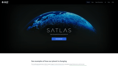
Satlas is an innovative platform that leverages AI to generate open geospatial data, allowing users to explore and analyze changes in our planet's infrastructure and environment. With a focus on renewable energy, marine infrastructure, and tree cover, Satlas provides high-resolution satellite imagery and detailed datasets that are freely accessible to the public. Whether you're a researcher, environmentalist, or simply curious about the world, Satlas offers powerful tools to visualize and understand the transformations occurring across the globe.
Satlas
Key Features of Satlas
-
AI-Generated Geospatial Data
Satlas utilizes advanced AI models to create high-resolution geospatial datasets. This allows users to access detailed information about various environmental changes, including deforestation, urban development, and renewable energy projects. -
Super-Resolution Technology
The platform employs super-resolution techniques to enhance low-resolution satellite imagery, providing clearer and more detailed views of specific areas. This feature is particularly useful for analyzing changes over time. -
Interactive Mapping
Users can explore an interactive map that showcases various applications, including marine infrastructure and tree cover. The map allows for side-by-side comparisons and animations to visualize changes effectively. -
Publicly Accessible Data
All datasets generated by Satlas are freely available for download, enabling offline analysis and research. This commitment to open data supports transparency and collaboration in environmental studies. -
Comprehensive AI Models
Satlas employs state-of-the-art AI architectures and training algorithms, utilizing a massive dataset known as SatlasPretrain, which contains over 30 TB of imagery and 300 million labels. This ensures high accuracy and reliability in the generated data. -
User-Friendly Interface
The platform is designed with user experience in mind, making it easy for users to navigate through various features and access the information they need without technical expertise.
Frequently Asked Questions about Satlas
What is Satlas?
Satlas is an AI-driven platform that generates open geospatial data, allowing users to explore and analyze environmental changes across the globe.
How can I access the data?
All datasets generated by Satlas are publicly available for free download, enabling users to conduct offline analysis.
What types of changes can I visualize using Satlas?
Users can visualize changes related to marine infrastructure, renewable energy projects, and tree cover, among others.
Is there a cost to use Satlas?
No, Satlas is completely free to use, and all data is accessible without any fees.
How does the super-resolution feature work?
The super-resolution feature enhances low-resolution satellite images, providing clearer and more detailed visuals for better analysis.
Search 10000+ Useful AI Tools By What You Need.
Copyright © 2025 AListForAi All rights reserved